Mapping Charleston Part II
- Jacob Mossbrook
- Mar 7
- 3 min read
Updated: Mar 27
Thanks to the grant Records Management was awarded by the South Carolina State Historical Records Advisory Board (SC SHRAB) Historical Records Regrant Program, our project, Mapping Charleston, is now fully underway. Our team is working hard to familiarize ourselves with PastPerfect, a cloud-based content management system, and start digitally cataloging our historical map and plat collection (c. 1787 to 2004) to increase public accessibility.


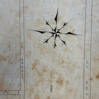


Several small drawings from the map collection. Oftentimes, smaller drawings within larger maps serve both functional and decorative purposes.
At this point, nearly all our maps in flat file storage have been through an initial round of indexing. We have collected information from the index card catalog system including each object’s original catalog ID, creator(s), title, date(s), physical description, scope and content, and additional points of interest to create a working Excel database from which we can pull information to build our PastPerfect catalog. Additionally, Records Specialist Kendall John has been identifying and researching map creators, particularly those who were City Engineers and Surveyors, and seeing if they have items in other City collections. Kendall has also begun preliminary research into street name changes to aid our map descriptions and improve searchability on PastPerfect for a modern audience.

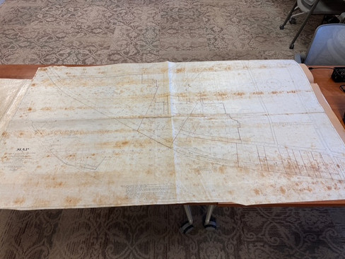


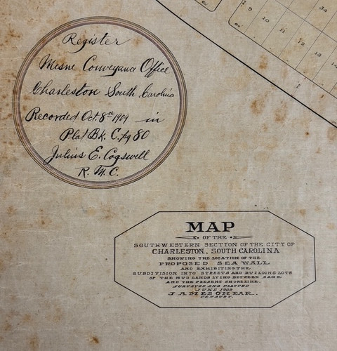
Left: one of our larger maps of the SW section of the city pulled out of the flat file for review. Right: detail of same map, showing the edge of the Peninsula along Ashley River and proposed Sea Wall at Murray Boulevard.
We have also begun to pull the maps out of storage to individually review each map’s condition and content to collect metadata for cross-referencing and note preservation concerns. Understandably, with approximately 1,670 maps, plats, surveys, and architectural drawings in the collection, this part of the process is proceeding slowly but steadily. Currently, we have completed this individual review for about 160 maps and have uncovered a wealth of information illustrating the evolution of Charleston’s development, expansion, transportation, public services, social climate, zoning, infrastructure, and more.


Maps from the collection demonstrating the wide variety of handwriting fonts used by City Engineers and Surveyors.
Personally, I have most enjoyed seeing each City Engineer’s or Surveyor’s personality show through their work. Oftentimes, the maps in the collection have related counterparts, whether they are preliminary rough sketches, copies for different purposes (e.g. a lot plan to illustrate building lots for auction vs. a lot plan of the same area to show its conveyance and subdivision), or parts of larger drawing sets related to projects like the Battery’s construction. Through all these documents, and especially rough drawings and survey field notes, you gain an appreciation for each creator’s style, artistry, and problem-solving skills. Many maps are dotted with survey calculations, test scribbles, doodles, drawings, and a stunning variety of handwritten fonts reflecting each map’s hierarchy of information and each map creator’s priorities and creativity. Past City Engineers like Louis J. Barbot and James H. Dingle produced hundreds of drawings shaping the Peninsula’s development, and the maps help illustrate the challenges they faced and how they overcame them.
As we continue working to catalog the collection, we hope to discover even more points of interest and share them with the public. We will be posting more blog updates along the way, and we are looking forward to future outreach programs and collaborations with local organizations and repositories.


Comments